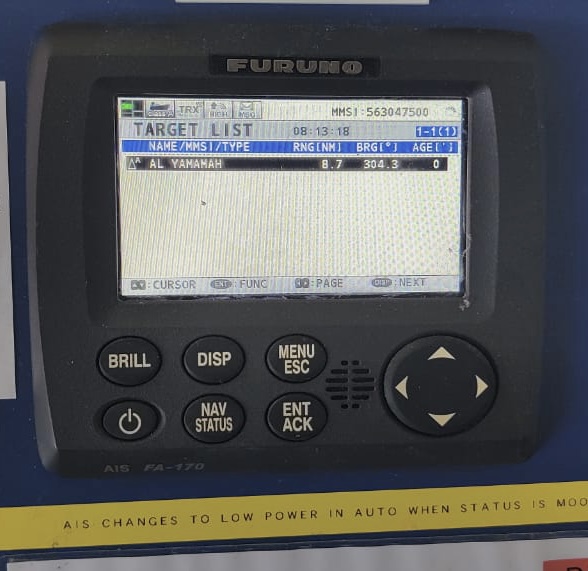
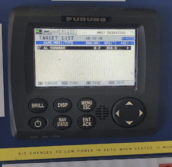
Automatic Identification System (AIS)
When you see a vessel around you and you need to call her for some reason, how will you identify that vessel. In earlier days you had to call her by his course, speed, latitude and longitude. That used to be quite confusing. Thus in order to facilitate that the AIS was introduced into marine industry.
To aid in maritime navigation and radio communication, the Automatic Identification System (AIS) was developed.
It exchanges automatically the navigational data via VHF channels between ships and between ships and shore. This way the AIS improves maritime safety for both people and the environment.
When installed on board a vessel, it serves as a means of identification. It’s a computerised tracking system that shows data on other ships, both stationary and in motion.
It is equipped with a VHF marine broadcast transponder system. The other important thing is that it is just to assist the watchkeeper, and it should not be used for collision avoidance.

While on land, AIS is used by VTS to identify, locate and monitor vessels in their area.
There are two kind of AIS in the marine industry. The types are based on the data it is broadcasting.
Table of contents
- working and principle of AIS
- modes of operation
- types of AIS
- types of data transmitted by AIS
- construction of AIS
- requirements
- SOLAS carriage requirements
- Limitations of AIS
- Maintenance
Working and Principle of AIS
A global positioning system (GPS) receiver, which can be built in or attached, is often used to find out where and when something is. Adding a differential GPS receiver makes it possible to find exact locations in coastal and inland waters.
Any other information can be taken electronically from devices on board using standard marine data connections. All ships with AIS normally give heading, course, and speed over ground.
There are 3 modes of operation for AIS:
Autonomous and continuous mode:
When operating in this mode, AIS determines its own reporting rate based on the ship’s current navigational mode, speed, and course. Additionally, the unit is responsible for scheduling its own timeslots. This is the default mode for all areas, but a responsible person on shore can change it to Assigned or Polled/Controlled mode.
Assigned/Controlled Mode:
Transmission times and/or intervals for vessel mobile stations can be remotely adjusted by the competent authority in charge of traffic surveillance. When a mobile station is in assigned mode, its reporting rate stays the same no matter where it is going or how fast it is going.
Polled Mode:
In this, all polling messages sent from a ship or other authoritative source will be immediately answered by the mobile station. The reply is sent back over the same channel as the initial query. Polled mode functioning does not interfere with the other two modes of operation.
Types OF AIS
Class A is required by the IMO for vessels of 300 gross tons and above involved in international voyages; for cargo ships of 500 gross tons and above not engaged in international voyages; and for passenger ships of any size.
Class B functionality is limited and is meant for non-SOLAS vessels. It was made for ships like work boats and pleasure boats, but the International Maritime Organization (IMO) does not require it.
Types of data transmitted by AIS
There are mainly three kinds of data transmitted by the AIS.
The data types are Static data, dynamic data and voyage related data.
Static Data
• MMSI (Maritime Mobile Service Identity)
• IMO number (where available)
• Call sign and name – Length and beam
• Type of ship
• Location of position-fixing antenna on the ship
Within two minutes of powering on, the system begins broadcasting ship static data at six-minute intervals.
Dynamic Data (depends on speed and course alteration)
• Ship’s position with accuracy indication and integrity status
• Universal Time Coordinated (UTC)
• Course over ground (COG)
• Speed over ground (SOG)
• Heading – Rate of turn (ROT) where available
The frequency of the data changes with the type of data. According to the ship’s speed and course, dynamic data is provided every 2 s to 3 min.
Information on the ship’s voyage, including its draft, hazardous cargo, destination, and expected arrival time, is broadcast every six minutes.
Voyage Related Data
• Ship’s draught
• Navigation status (manual input)
• Hazardous cargo (type)
• Destination and ETA (at master’s discretion)
Every six minutes, data relevant to the journey is sent.
Short Safety Related Messages
Free format texts can be sent to a single recipient or to every station in a given area.
Construction of AIS
The following components make up the AIS system:
Transponder
Monitor Unit
Antennae
Power Supply Unit
I/O Signals
Transponder
AIS transponders are dual-purpose devices that can send and receive signals. Depending on the maker’s design, this component may be fitted alone or in tandem with the monitoring component.
Both the VHF antenna and a GPS antenna (and associated GPS receiver) are attached to it. Some companies produce single-antenna products that rely on the GPS feed data from the ship for navigation.
Channels 87B (161.975 MHz) and 88B (156.025 MHz) are used for transmission or frequency range of 156.025 MHz to 162.025MHz. The Transponder plots the position of the inputted GPS data on the display screen and uses it to compute the distance between the two ships.
Monitoring Unit
The monitoring u it is there to monitor the condition and health of the AIS system.
When we self test the AIS, the results of the ROM, RAM, and backup data tests, either “OK” or “NG” (No Good), are displayed on the startup screen alongside the program version number.
If any check results show “NG” (No Good), resetting the power may help get things back to normal.
If it doesn’t help, try contacting the maker for guidance. Plotter display shows when start-up test is complete and system is ready for use. In order to transmit data, all of the relevant details are entered into the AIS system by hand before each voyage begins via the display screen.
Antenna
Data transmission and reception in the AIS are handled by VHF systems, while positioning is handled by GPS. The VHF antenna is linked to the transponder unit so that data may be sent to and received from the ship, and the GPS receiver, which is integrate, makes use of a GPS parabolic antenna to pinpoint nearby vessels on the screen. Some transponders only have one antenna, which is used for VHF data exchange, and a separate GPS data stream, which is used for charting on the screen. Each antenna is connected to the transponder via coaxial cable.
Power Supply Unit
The AIS has an AC-DC converter unit that takes the ship’s 110-220 V AC power supply and turns it into 24V DC. In case of emergency, it draws power from the ship’s backup 24 V DC power supply.
I/O Signals
For communication with the outside world, the AIS system processes input and output signals.
This is a list of output signals:
• External display
• Pilot plug
• Alarm system
• PC
• Beacon receiver
• VDR
• Radar
• INMARSAT satellite
• The input signals are as follows:
• Sensors
• Gyrocompass
• GPS
• Rate of turn
Requirements for AIS
The International Maritime Organization (IMO) mandated in 2000 (as part of a revised new Regulation 19 of chapter V of SOLAS) that all vessels be equipped with automatic identification systems (AIS) capable of automatically providing information about the vessel to other vessels and to coastal authorities, with a phased implementation period spanning 1 July 2002 through 1 July 2008. Recommendations on Performance Standards for the Universal Automatic Identification System are included in Resolution MSC.74(69) (AIS).
The regulations require that AIS shall:
● deliver information, including the ship’s identification, type, position, course, speed, navigational status, and other safety-related information, automatically to shore stations, other ships, and aircraft that are correctly equipped;
● They receive information automatically from similarly equipped ships
● Monitor and track ships.
● Communicate information with on-shore facilities.
SOLAS Carriage Requirement
SOLAS regulation V/19.2.4 governs the transportation of AIS onboard vessels. The regulation mandates that AIS be installed on all ships of:
● 300 gross tons or more are involved in foreign travel.
● Cargo ships with a gross tonnage of 500 or more that are not involved in international voyages.
● all passenger vessels, regardless of size.
The requirement went into effect for all vessels on December 31, 2004.
Limitations of AIS
● The reliability of AIS data received depends on the precision of AIS data sent.
● The AIS display may not use the WGS 84 datum when showing the locations of ships.
● Don’t rely too much on AIS data for navigation until steps can be taken to make sure that all ships sending data offer the required level of accuracy and integrity for all sensors that are connected.
● Users must be cognisant of the fact that incorrect data transfer can put other ships in danger in addition to their own. Users are still responsible for all data they enter and all data added by sensors.
● Some of the real-time data that AIS sends out may come from sensors whose accuracy hasn’t been checked or whose integrity hasn’t been closely watched.
● Small boats, and fishing vessels in particular, may not have room for an AIS system. AIS will not pick up on other potential radar echo-making floating objects.
● When using a ship’s nautical display, mariners should be wary of this imitation. So, OOW shouldn’t jump to conclusions about the traffic situation based solely on AIS data.
● The OOW should always keep in mind that even ships that are required to have AIS may turn it off if the captain thinks it is necessary.
● The OOW shouldn’t assume that the information they get from other ships is as good and accurate as the information they can get on their own ship.
Maintenance
To keep functioning normally, frequent maintenance is essential. It’s recommended to schedule regular monthly checks.
Connectors
Verify that the transponder and the monitor are properly linked by checking their back panel connectors.
Cabling
See whether there’s any damage to the wiring. If it is broken, replace it with a new one.
Ground Terminal
Make sure there is no rust in the ground terminal of the tracking and transceiver units. Clean it if it is dirty.
Ground Wire
Verify that the monitoring unit’s and transponder’s grounding wires are securely secured.
Monitoring Unit, Transponder Unit
A soft, dry cloth is recommended for wiping down appliances to remove dust and dirt. Use a combination of tissue paper and LCD cleaner to wipe the screen gently to avoid scratching it. Make use of an LCD cleaner, wiping slowly with tissue paper to dissolve the dirt or salt deposits, in order to get rid of them. Frequently replacing the paper prevents the LCD from being scratched by salt or grime. Thinner, acetone, and benzene are all solvents that should be avoided because of the damage they can do to electronic device.


That means you’ll lead some new features and have access to additional channels where you can pick up visibility, without having to make sense of some confused, vade-mecum migration process. https://googlec5.com